Introduction
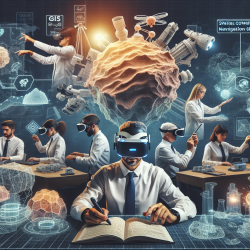
Spatial skills are essential in various STEM fields, particularly in geosciences, where large-scale spatial thinking is crucial. A recent study titled "Beyond small-scale spatial skills: Navigation skills and geoscience education" highlights the significance of large-scale navigation skills in STEM success, especially in GEO disciplines. This blog aims to guide practitioners on how to leverage these findings to enhance their skills and outcomes for children.
Understanding the Research
The research conducted two studies to explore the relationship between navigation skills and geoscience education. In the first study, experienced geologists demonstrated superior navigation skills compared to psychologists, indicating that geologists are more adept at integrating separate routes into a cohesive cognitive map. The second study involved novice Geographic Information Systems (GIS) students who exhibited superior baseline navigational competence compared to non-STEM students and showed greater improvement in spatial skills over a semester.
Key Findings
- Geologists have higher navigational competence than non-STEM professionals, emphasizing the importance of large-scale spatial skills in GEO fields.
- GIS students not only start with better spatial skills but also improve significantly over time, suggesting the potential of GIS tools in enhancing spatial cognition.
- Spatial skills are malleable, and improvements can be durable and generalizable, making early spatial training crucial for STEM success.
Implications for Practitioners
For practitioners, especially those working with children, integrating spatial cognition training into educational curricula can have long-lasting benefits. Here are some actionable steps:
- Incorporate GIS Tools: Use GIS software in classroom settings to enhance students' spatial reasoning and navigation skills. This can be particularly beneficial in geography and science classes.
- Focus on Large-Scale Spatial Thinking: Encourage activities that require children to think about spatial relationships on a larger scale, such as map reading and route planning.
- Utilize Virtual Environments: Implement virtual navigation paradigms like Virtual Silcton to provide students with immersive experiences that can improve their spatial skills.
- Encourage Self-Selection in STEM: Support students in identifying and pursuing STEM fields that align with their spatial strengths, potentially leading to better educational and career outcomes.
Conclusion
The research underscores the importance of spatial skills in STEM success and the potential of GIS tools to enhance these skills from an early age. By integrating these findings into practice, educators and therapists can foster better outcomes for children, preparing them for future STEM opportunities.
To read the original research paper, please follow this link: Beyond small-scale spatial skills: Navigation skills and geoscience education.