Introduction
As a speech-language pathologist, you might wonder how understanding school neighborhoods can improve your practice. Recent research titled Identification of Contrastive and Comparable School Neighborhoods for Childhood Obesity and Physical Activity Research provides fascinating insights into how environmental factors influence childhood obesity and physical activity. By leveraging Geographic Information Systems (GIS) and cluster analysis, this study offers a data-driven approach to selecting neighborhoods for health studies, which can be pivotal in designing effective interventions.
Understanding the Research
The study utilized GIS technology to integrate data from various sources such as land use, traffic, crime, and census tracts. This integration allowed researchers to generate objective measures of school neighborhood characteristics. By applying hierarchical cluster analysis, they categorized school districts into groups based on their neighborhood characteristics. This method identified eight school neighborhoods that were contrastive and comparable for a childhood obesity and physical activity study.
Key Findings
- GIS and cluster analysis can objectively characterize urban neighborhoods.
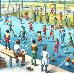
- Identified neighborhoods vary significantly in terms of land use and safety, affecting childhood obesity and physical activity.
- Neighborhoods with higher violent crime rates and traffic volumes were associated with higher obesity rates.
- Schools with better access to parks and lower crime rates showed increased physical activity levels among children.
Implications for Practitioners
For practitioners, understanding the environmental context of the schools they work with can be transformative. Here’s how you can apply these findings:
- Data-Driven Interventions: Use GIS data to understand the environmental factors affecting your students. Tailor interventions to address specific neighborhood challenges.
- Collaboration with Schools: Work with schools to advocate for safer environments and better access to recreational spaces.
- Community Engagement: Engage with community stakeholders to address broader social determinants of health, such as safety and accessibility.
Encouraging Further Research
This study is a stepping stone for further research into how neighborhood environments impact childhood health. Practitioners are encouraged to explore GIS tools and collaborate with researchers to expand this body of knowledge. By doing so, we can develop more effective strategies to combat childhood obesity and promote physical activity.
Conclusion
Understanding the influence of school neighborhoods on childhood obesity and physical activity is crucial for designing effective interventions. By utilizing GIS and cluster analysis, we can make informed decisions that lead to healthier outcomes for children. For those interested in delving deeper into this research, I highly recommend reading the original paper.
To read the original research paper, please follow this link: Identification of contrastive and comparable school neighborhoods for childhood obesity and physical activity research.